Maps and Gazetteers
HISTORIC MAPS
Burdett’s Map of Derbyshire 1791 – £10
This was the first large scale map of the county at a scale or one inch to the mile, produced just as the industrial revolution was taking off in the county. Reproduced on 18 A3 size sheets in black and white, with an explanatory text, in a slide binder.
Borough of Derby Map 1852 – £15
A fascinating large scale map produced for the Local Board of Health capturing the development of Derby in the middle of the 19th Century. This is a full colour facsimile on 17 A3 size sheets, with an explanatory text, in a slide binder.
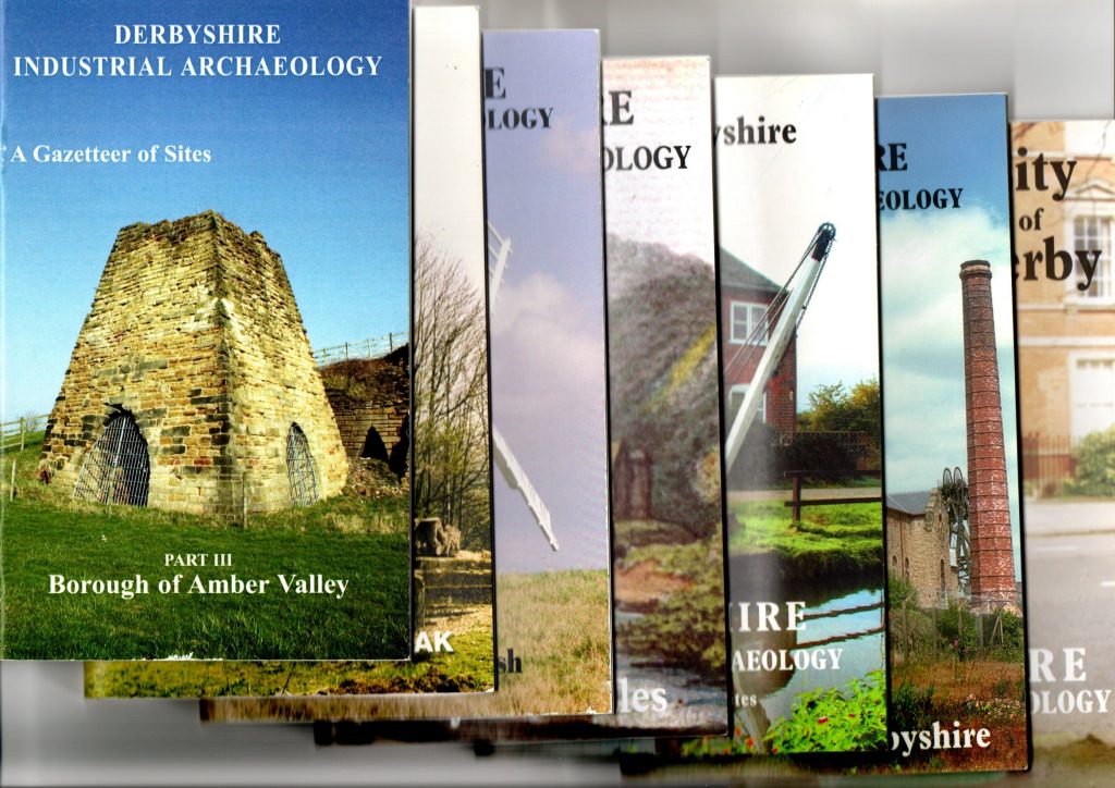
INDUSTRIAL ARCHAEOLOGY GAZETTEERS – £2
Over a period of 20 years, members of the Industrial Archaeology Section undertook a parish by parish review to identify significant sites of industrial archaeology interest across the county. The results are published as a series of convenient pocket sized booklets, with a brief description of each site and its national grid reference.
- IA Gazetteer 1 High Peak
- IA Gazetteer 2 Erewash
- IA Gazetteer 3 Amber Valley – SOLD OUT
- IA Gazetteer 4 Derbyshire Dales – ONLY A FEW LEFT
- IA Gazetteer 5 North East Derbyshire, Chesterfield and Bolsover – ONLY A FEW LEFT
- IA Gazetteer 6 South Derbyshire
- IA Gazetteer 7 City of Derby
Please enquire via publications@derbyshireas.org.uk for availability and the postal charges that will apply before sending money.
ELECTRONIC PUBLICATIONS – PDF DOWLOADS
Industrial Archaeology along the River Derwent
A 12 page guide produced by Mark Higginson to accompany our Summer 2024 trips on the Derby Riverboat from central Derby towards Darley Abbey. The guide identifies key sites along the riverside on historic maps, and provides illustrations of their former appearance. The guide can also be used as part of a self-conducted circular walk.